Near Little River Canyon National Preserve
Deep sandstone canyon on Lookout Mountain with waterfalls, swimming holes, and Canyon Rim Drive overlooks. Camp at DeSoto State Park next door.
Live federal data (RIDB) + curated · AL
Showing places within ~40 miles of Little River Canyon National Preserve, nearest first.
Drive times are rough estimates from metro Atlanta / Conyers — check your own route before you leave. Confirm fees, passes, and access on the official page before you go.
Map of results
Click a pin for the site. For turn-by-turn, open a site and use Google / Apple / Waze — we don't replace your preferred maps app.
Research map · not turn-by-turn nav
DeSoto State Park — Primitive Campground (walk-in tent)
State ParkAlabama State Parks — DeSoto State Park· 7 mi from Little River Canyon National Preserve
~3h 4m
0.1 mi
None to camp
Included — short walk in from the primitive lot; gate key issued at check-in
Rates vary by season — call 256-845-5075. Plus the $5.25 reservation fee and 4.25% resort fee per night.
Yes
The quiet way to sleep at DeSoto — 18 walk-in tent sites in the woods with fire rings, a vault toilet and water, no RVs and no hookups. Same 15-minute drive to the canyon, and you can still use the showers at the improved loop. Two backpacking shelters (Never-Never Land, 0.75 mi from the Lost Falls trailhead, and CCC Quarry) if you want a true hike-in night.
DeSoto State Park — Improved Campground
State ParkAlabama State Parks — DeSoto State Park· 8 mi from Little River Canyon National Preserve
~3h 4m
Drive-up
None to camp. America the Beau…
Included with your campsite
Rates vary by season and are not published online — call 256-845-5075. Plus a one-time $5.25 reservation fee and a 4.25% resort fee per night, paid in full at booking.
Yes
The base camp for Little River Canyon: a 3,500-acre state park on Lookout Mountain 8 miles northeast of Fort Payne, 15 minutes from the Canyon Center. Wooded full-hookup sites with real showers and laundry, plus the park's own waterfalls and 35 miles of trail. Book on the Alabama State Parks site — not Recreation.gov — or call the campground desk directly.
Cherokee Rock Village
DevelopedCherokee County / Southeastern Climbers Coalition — Leesburg, AL· 19 mi from Little River Canyon National Preserve
~3h 16m
Drive-up
Day use is charged per vehicle…
Day use: about $7 per car (vans/buses more) — confirm on site
$19/night for the first-come tent-only section; reserved brow and RV sites vary
No — first come
A boulder field of house-sized sandstone towers on the brow of Lookout Mountain above Weiss Lake, about 40 minutes southwest of Little River Canyon. It is Alabama's best-known climbing area, and the reason it belongs on this list for a late plan: a tent-only section stays first-come, first-served at $19 a night, so you can drive up without a reservation.
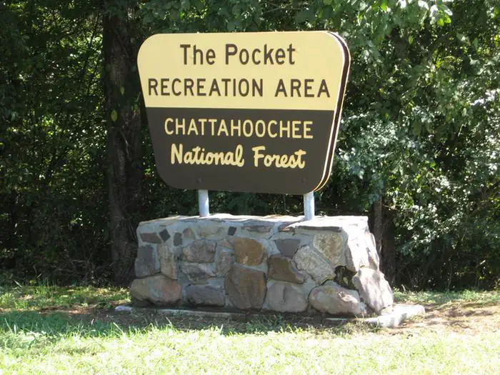
Pocket Campground
DevelopedUSDA Forest Service — Chattahoochee-Oconee National Forest· 34 mi from Little River Canyon National Preserve
~2h 37m
See site details
Check Recreation.gov / facilit…
See facility details
See Recreation.gov
Yes
The Pocket Recreation Area is located within the Chattahoochee-Oconee National Forest in the ridges and valleys of northwest Georgia. The campground sits in a low lying geographical area between Horn and Mill mountains. This low lying area was formed by limestone dissolving, leaving the ridges above and valleys below. These ridges are rich in iron ore "pockets" giving this area its name. Deer and turkeys thrive in the surrounding forest. Spring wildflowers and autumn colors abound, showcasing the beauty of the region. Nearby trails and overlooks allow visitors to enjoy the National Forest from different perspectives. The Pocket area is rich in cultural and historical history. In the mid-1800
Data source: RIDB + curated Alabama state parks, destinations & county parks (verified Aug 2026).