Near Little River Canyon National Preserve
Deep sandstone canyon on Lookout Mountain with waterfalls, swimming holes, and Canyon Rim Drive overlooks. Camp at DeSoto State Park next door.
Live federal data (RIDB) + curated · AL
Showing places within ~40 miles of Little River Canyon National Preserve, nearest first.
Drive times are rough estimates from metro Atlanta / Conyers — check your own route before you leave. Confirm fees, passes, and access on the official page before you go.
Map of results
Click a pin for the site. For turn-by-turn, open a site and use Google / Apple / Waze — we don't replace your preferred maps app.
Research map · not turn-by-turn nav
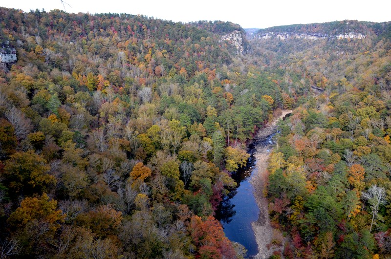
Little River Canyon National Preserve
Destination · day useNational Park Service — Little River Canyon National Preserve· < 1 mi from Little River Canyon National Preserve
~2h 53m
None for the preserve, Little …
Free — Little River Falls lot holds 100 cars with RV/bus spaces
NO camping anywhere in the preserve — day use only. Nearest camping: DeSoto State Park, 15 min north.
A 15,000-acre sandstone canyon on Lookout Mountain about 10 miles east of Fort Payne: Little River Falls, a 23-mile rim parkway with eight overlooks, canyon swim holes, and a 4WD backcountry. Open sunrise to sunset with no entrance fee (except Canyon Mouth Park). There is no camping in the preserve — sleep at DeSoto State Park next door and drive in each morning.
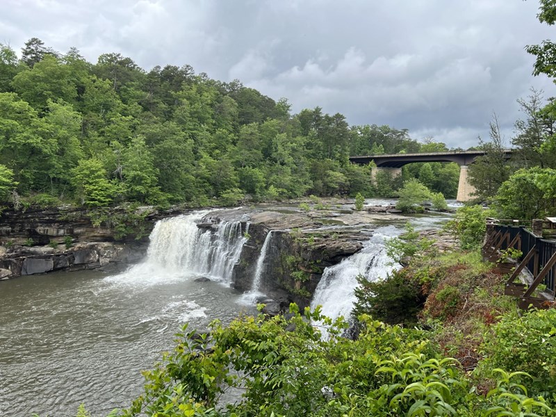
Little River Falls & Blue Hole (free day use)
Destination · day useNational Park Service — Little River Canyon National Preserve· < 1 mi from Little River Canyon National Preserve
~2h 52m
None
Free — 100-car lot on the west side of the AL-35 bridge, restrooms mid-lot
No camping and no overnight parking; the area closes after dark.
The 45-foot waterfall where the canyon begins, right at the AL-35 bridge — the easiest big payoff in the preserve. Free lot, restrooms, and an ADA boardwalk to the overlook. By late summer the flow drops and the ledges above and below the falls turn into wading and swimming pools; the Little Falls Trail drops 137 stone steps to a river-wide sandstone shelf that is the local favorite swim spot.
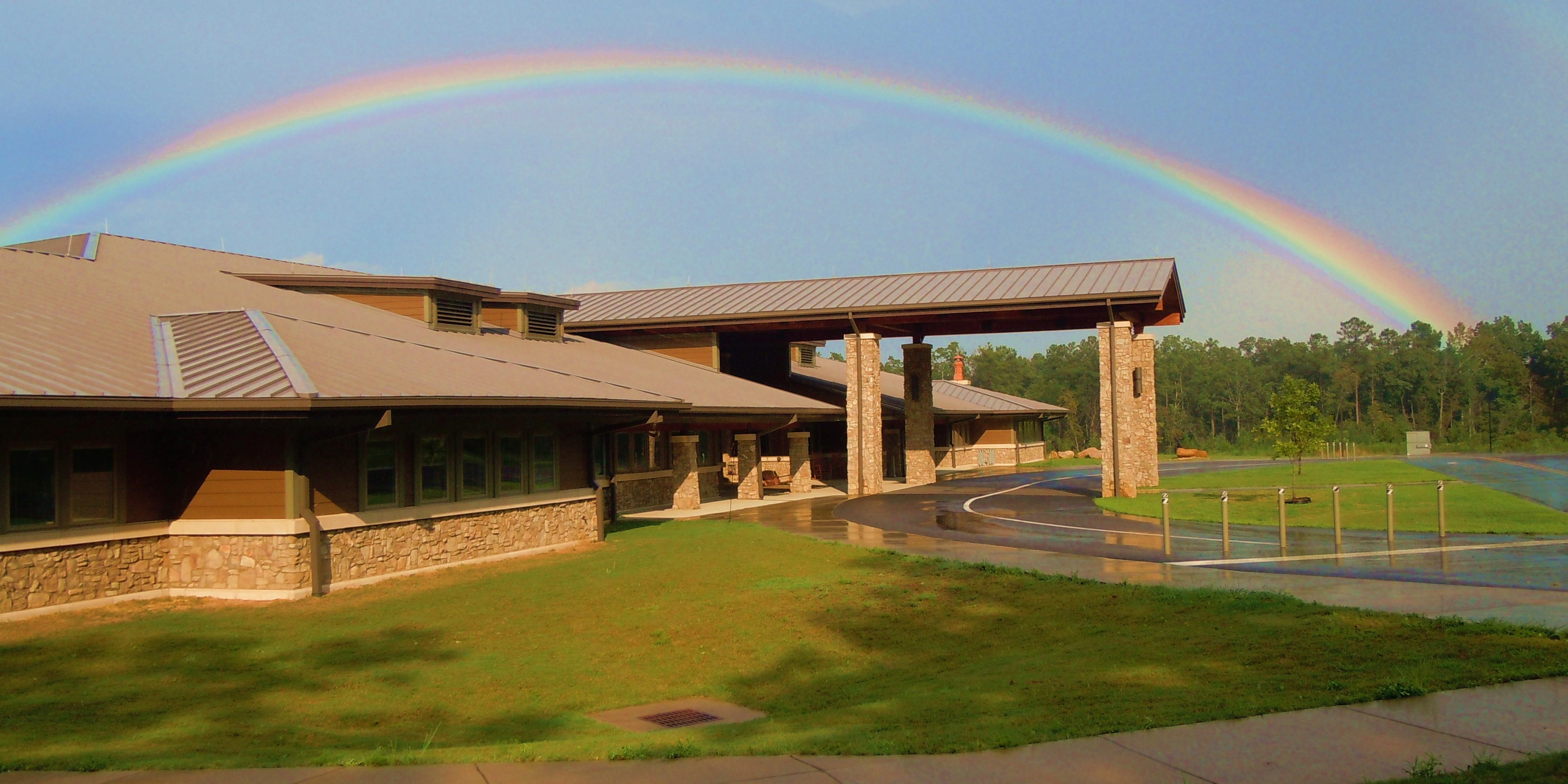
Jacksonville State University Little River Canyon Center
Destination · day useNational Park Service — Little River Canyon National Preserve· < 1 mi from Little River Canyon National Preserve
~3h 8m
Check the facility page (day-u…
See facility details
No camping here (visitor center) — camp nearby
The Jacksonville State University Little River Canyon Center is located adjacent to Little River Canyon National Preserve. National Park Service staff and Volunteers and Jacksonville State University staff will greet you and help you plan your visit. Amenities include: Information desk, restrooms, movie, gift shop, trails, and picnic tables. Hours are 10 AM - 4 PM Central Standard Time. Closed Thanksgiving, Christmas, and New Years Day.
DeSoto State Park — Primitive Campground (walk-in tent)
State ParkAlabama State Parks — DeSoto State Park· 7 mi from Little River Canyon National Preserve
~3h 4m
0.1 mi
None to camp
Included — short walk in from the primitive lot; gate key issued at check-in
Rates vary by season — call 256-845-5075. Plus the $5.25 reservation fee and 4.25% resort fee per night.
Yes
The quiet way to sleep at DeSoto — 18 walk-in tent sites in the woods with fire rings, a vault toilet and water, no RVs and no hookups. Same 15-minute drive to the canyon, and you can still use the showers at the improved loop. Two backpacking shelters (Never-Never Land, 0.75 mi from the Lost Falls trailhead, and CCC Quarry) if you want a true hike-in night.
DeSoto State Park — Improved Campground
State ParkAlabama State Parks — DeSoto State Park· 8 mi from Little River Canyon National Preserve
~3h 4m
Drive-up
None to camp. America the Beau…
Included with your campsite
Rates vary by season and are not published online — call 256-845-5075. Plus a one-time $5.25 reservation fee and a 4.25% resort fee per night, paid in full at booking.
Yes
The base camp for Little River Canyon: a 3,500-acre state park on Lookout Mountain 8 miles northeast of Fort Payne, 15 minutes from the Canyon Center. Wooded full-hookup sites with real showers and laundry, plus the park's own waterfalls and 35 miles of trail. Book on the Alabama State Parks site — not Recreation.gov — or call the campground desk directly.
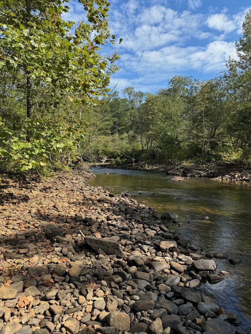
Canyon Mouth Park ($15/vehicle day use)
Destination · day useNational Park Service — Little River Canyon National Preserve· 8 mi from Little River Canyon National Preserve
~2h 57m
$15 per vehicle per day, or $3…
Included in the $15 entrance
No camping. Gates close promptly (summer 8 AM–7 PM Central) — vehicles left inside get ticketed or locked in.
The shady family end of the canyon, at its southern mouth near Cedar Bluff in Cherokee County — and the only fee area in the preserve. Easy river access, lots of shade, grills, and a flat one-mile trail along the water. Reach it from AL-273 onto Cherokee CR-275, or down 11 steep, winding miles from Eberhart Point (no trailers or RVs).
DeSoto Falls (day use)
Destination · day useAlabama State Parks — DeSoto State Park· 11 mi from Little River Canyon National Preserve
~3h 10m
None stated for the falls day-…
Day-use lot at the falls overlook
No camping at the falls — camp in DeSoto State Park a few minutes south.
A tall waterfall on the West Fork of the Little River in its own day-use area a few miles north of DeSoto State Park's campground — one of the most photographed falls in Alabama. Short walk from the lot to the overlooks. Flow depends on recent rain, so late summer can be thin.
Cherokee Rock Village
DevelopedCherokee County / Southeastern Climbers Coalition — Leesburg, AL· 19 mi from Little River Canyon National Preserve
~3h 16m
Drive-up
Day use is charged per vehicle…
Day use: about $7 per car (vans/buses more) — confirm on site
$19/night for the first-come tent-only section; reserved brow and RV sites vary
No — first come
A boulder field of house-sized sandstone towers on the brow of Lookout Mountain above Weiss Lake, about 40 minutes southwest of Little River Canyon. It is Alabama's best-known climbing area, and the reason it belongs on this list for a late plan: a tent-only section stays first-come, first-served at $19 a night, so you can drive up without a reservation.
Crockford-Pigeon Mountain WMA (Blue Hole area)
WMA / WildlifeGeorgia DNR· 27 mi from Little River Canyon National Preserve
~2h 10m
Drive-up
Georgia WMA / land access rule…
Check current regulations
Usually free with proper credentials
No — first come
Wildlife Management Area on the northwest side of Georgia with primitive camping opportunities. Different feel from national forest — more open and rugged in places.
Pocket Campground
DevelopedUSDA Forest Service — Chattahoochee-Oconee National Forest· 34 mi from Little River Canyon National Preserve
~2h 37m
See site details
Check Recreation.gov / facilit…
See facility details
See Recreation.gov
Yes
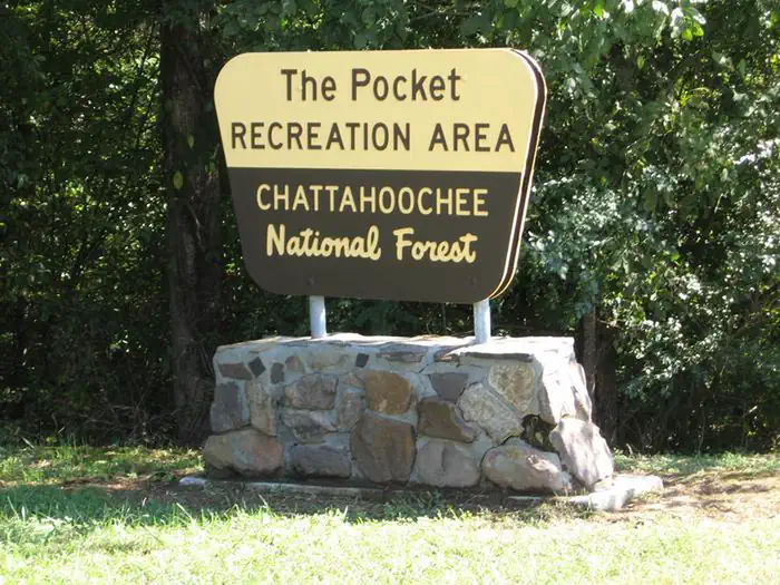
The Pocket Recreation Area is located within the Chattahoochee-Oconee National Forest in the ridges and valleys of northwest Georgia. The campground sits in a low lying geographical area between Horn and Mill mountains. This low lying area was formed by limestone dissolving, leaving the ridges above and valleys below. These ridges are rich in iron ore "pockets" giving this area its name. Deer and turkeys thrive in the surrounding forest. Spring wildflowers and autumn colors abound, showcasing the beauty of the region. Nearby trails and overlooks allow visitors to enjoy the National Forest from different perspectives. The Pocket area is rich in cultural and historical history. In the mid-1800
POCKET PICNIC SHELTER
Destination · day useUSDA Forest Service — Chattahoochee-Oconee National Forest· 34 mi from Little River Canyon National Preserve
~2h 37m
Check Recreation.gov / facilit…
See facility details
No camping here (day-use shelter) — camp nearby
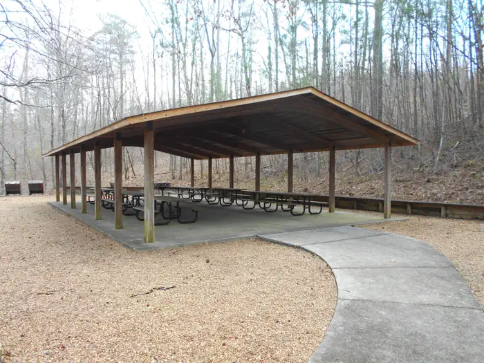
Pocket Picnic Shelter is a reservable shelter in the Pocket Recreation Area located in Armuchee, Ga. The shelter is a great location to hold family get togethers, birthday parties, work luncheons, retirement parties, or any other celebration one can think of. The Pocket Recreation Area is located within the Chattahoochee-Oconee National Forest in the ridges and valleys of northwest Georgia. The shelter sits in a low lying geographical area between Horn and Mill mountains. This low lying area was formed by limestone dissolving, leaving the ridges above and valleys below. These ridges are rich in iron ore "pockets" giving this area its name. Deer and turkeys thrive in the surrounding forest. S
Data source: RIDB + curated Alabama state parks, destinations & county parks (verified Aug 2026).